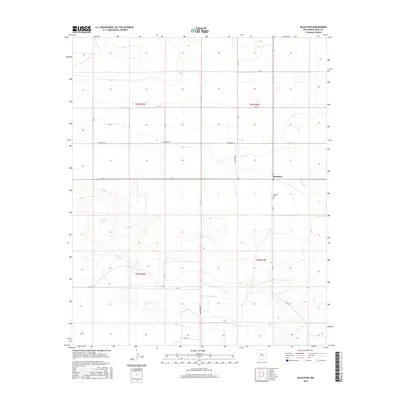
2017 Map of McAlister
USGS Topo · Published 2017About this map
McAlister sits at the intersection of a vast grid of section roads in this part of Quay County, representing the persistent ranching and farming heritage of the eastern New Mexico plains. The area is defined by its drainage patterns and seasonal water sources, most notably Alamosa Cr which winds through the southern townships. Local history and genealogy are centered around the McAlister Cem located just south of the main settlement. Small depressions in the terrain collect water to form landmarks like Caballo Lake and Burk Lake, which serve as vital points in an otherwise arid landscape. The map meticulously records the township and range lines, including t6n r29e and t5n r30e, illustrating how the land was systematically partitioned for settlement and grazing.
Find a feature on this map
23 named features on this map. Tap any name to fly to it.
Don’t see what you’re looking for? This feature index may not catch every label — zoom into the map to look around manually.
Map Details
Editions of this 2017 McAlister Map
This is the sole edition of this map. No revisions or reprints were ever made.
Other maps of this area

1954 · Clovis
USGS Topo · 1:250,000

1958 · Clovis
USGS Topo · 1:250,000

1970 · Jordan
USGS Topo · 1:24,000
1970 · Cunavea Basin
USGS Topo · 1:24,000

1971 · Ragland
USGS Topo · 1:24,000

1973 · Weber City
USGS Topo · 1:24,000

1973 · House
USGS Topo · 1:24,000
1973 · Peach Canyon
USGS Topo · 1:24,000

1973 · Mc Alister
USGS Topo · 1:24,000

1973 · Field SW
USGS Topo · 1:24,000