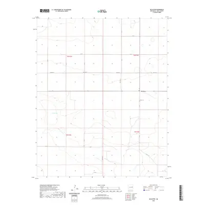
2020 Map of McAlister
USGS Topo · Published 2020About this map
McAlister occupies a central position in this portion of Quay County, illustrating the sparse settlement patterns and water-dependent geography of the High Plains. The landscape is defined by its drainage systems, including the southward-flowing Alamosa Cr and the presence of ephemeral water bodies like Caballo Lake and Burk Lake. For local historians and genealogists, the McAlister Cem remains a critical landmark for tracing the community's early residents. The map's grid-based road system, dominated by routes such as Quay Road 31 and Quay Road AS, underscores the region's agricultural and ranching organization. This data reflects a modern era of mapping that still relies on traditional landmarks and township lines, such as t6n r29e, to define property and political boundaries.
Find a feature on this map
23 named features on this map. Tap any name to fly to it.
Don’t see what you’re looking for? This feature index may not catch every label — zoom into the map to look around manually.
Map Details
Editions of this 2020 McAlister Map
This is the sole edition of this map. No revisions or reprints were ever made.
Other maps of this area

1954 · Clovis
USGS Topo · 1:250,000

1958 · Clovis
USGS Topo · 1:250,000

1970 · Jordan
USGS Topo · 1:24,000
1970 · Cunavea Basin
USGS Topo · 1:24,000

1971 · Ragland
USGS Topo · 1:24,000

1973 · Weber City
USGS Topo · 1:24,000

1973 · House
USGS Topo · 1:24,000
1973 · Peach Canyon
USGS Topo · 1:24,000

1973 · Mc Alister
USGS Topo · 1:24,000

1973 · Field SW
USGS Topo · 1:24,000