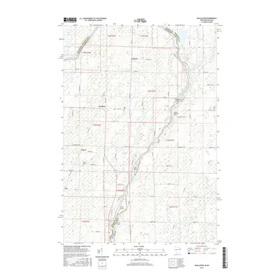
2016 Map of McAllister
USGS Topo · Published 2016About this map
The Menominee River serves as the winding border between Marinette County, Wisconsin, and Menominee County, Michigan, defining the landscape of this 2016 survey. The small settlement of McAllister sits near the river’s edge, anchored by the Wallace McAllister Bridge which connects the two states. This rural area is characterized by a mix of agricultural plots and dense riverbottom topography, where several named islands including Long Island, Twin Island, and Maggies Island disrupt the river's flow.
Find a feature on this map
76 named features on this map. Tap any name to fly to it.
Don’t see what you’re looking for? This feature index may not catch every label — zoom into the map to look around manually.
Map Details
Editions of this 2016 McAllister Map
This is the sole edition of this map. No revisions or reprints were ever made.
Other maps of this area

1939 · Marinette
USGS Topo · 1:48,000

1939 · Porterfield
USGS Topo · 1:48,000

1942 · Porterfield
USGS Topo · 1:48,000

1942 · Wausaukee
USGS Topo · 1:48,000

1947 · Wausaukee
USGS Topo · 1:48,000

1949 · Stephenson
USGS Topo · 1:48,000

1954 · Escanaba
USGS Topo · 1:250,000

1957 · Escanaba
USGS Topo · 1:250,000

1958 · Escanaba
USGS Topo · 1:250,000

1963 · Porterfield
USGS Topo · 1:62,500