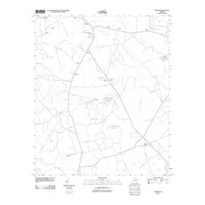
2011 Map of McBean
USGS Topo · Published 2011About this map
McBean sits at the northern edge of this landscape where rural crossroads and family homesteads define the character of eastern Georgia. The terrain is deeply inscribed with family history, evidenced by a high density of small burial grounds including Crockett Cemetery, Cosnahan Cemetery, and Fulcher Cemetery. The water system is heavily managed, featuring numerous small reservoirs such as Southland Timber Lake, Boyd Lake, and Crockett Lake, each supported by its own namesake dam. These ponds feed into a network of waterways including McBean Creek and Boggy Gut Creek that drain toward the Savannah River basin.
Find a feature on this map
74 named features on this map. Tap any name to fly to it.
Don’t see what you’re looking for? This feature index may not catch every label — zoom into the map to look around manually.
Map Details
Editions of this 2011 McBean Map
This is the sole edition of this map. No revisions or reprints were ever made.
Other maps of this area

1919 · Gough
USGS Topo · 1:62,500

1920 · Greens Cut
USGS Topo · 1:62,500

1921 · Augusta
USGS Topo · 1:62,500

1922 · Hephzibah
USGS Topo · 1:62,500

1943 · Greens Cut
USGS Topo · 1:62,500

1943 · Augusta East
USGS Topo · 1:125,000

1943 · Augusta
USGS Topo · 1:62,500

1948 · Hephzibah
USGS Topo · 1:62,500

1948 · Gough
USGS Topo · 1:62,500
1950 · Hephzibah
USGS Topo · 1:24,000