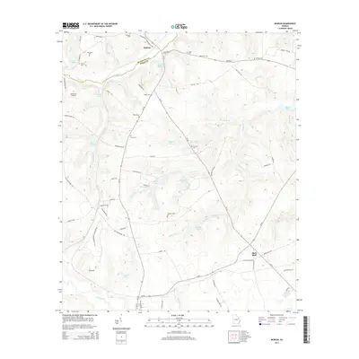
2014 Map of McBean
USGS Topo · Published 2014About this map
McBean sits at the northern edge of this landscape, marking the transition from southern Richmond County into Burke County along McBean Cr. The area is characterized by a high density of family and community burial grounds, including the Crockett Cem, Mixon Cem, and Knight Cem, which provide significant points of interest for genealogists and local historians. The terrain is defined by an intricate network of waterways such as Boggy Gut Cr and Mount Zion Br, punctuated by numerous small impoundments like Miles Pond and Hagler Lake. To the west, the Sandy Hill Airport represents the modest aviation infrastructure of the region. Near the southern border, the settlement of Shell Bluff and the waters of Brier Creek anchor the rural landscape, which remains largely shaped by timber interests as evidenced by Southland Timber Lake.
Find a feature on this map
77 named features on this map. Tap any name to fly to it.
Don’t see what you’re looking for? This feature index may not catch every label — zoom into the map to look around manually.
Map Details
Editions of this 2014 McBean Map
This is the sole edition of this map. No revisions or reprints were ever made.
Other maps of this area

1919 · Gough
USGS Topo · 1:62,500

1920 · Greens Cut
USGS Topo · 1:62,500

1921 · Augusta
USGS Topo · 1:62,500

1922 · Hephzibah
USGS Topo · 1:62,500

1943 · Greens Cut
USGS Topo · 1:62,500

1943 · Augusta East
USGS Topo · 1:125,000

1943 · Augusta
USGS Topo · 1:62,500

1948 · Hephzibah
USGS Topo · 1:62,500

1948 · Gough
USGS Topo · 1:62,500
1950 · Hephzibah
USGS Topo · 1:24,000