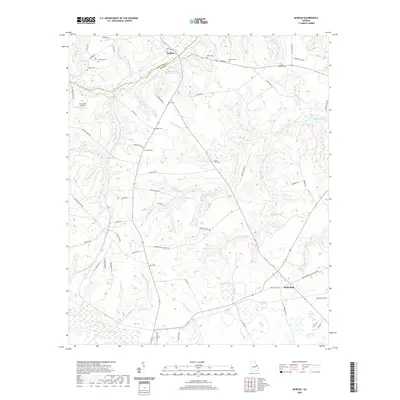
2020 Map of McBean
USGS Topo · Published 2020About this map
McBean sits at the junction of the Richmond Co and Burke Co line, anchoring a landscape defined by its complex network of creeks and small family-named cemeteries. This modern survey illustrates how long-standing burial sites like Cosnahan Cem, Fulcher Cem, and Mixon Cem remain preserved amidst the evolving agricultural and residential footprints of the region. The drainage patterns of McBean Creek and Boggy Gut Creek dictate the local geography, feeding into a series of ponds and lakes including Miles Pond, Hagler Lake, and Fryhofer Lake. To the south, Shell Bluff and the nearby Shell Bluff Spring indicate the distinctive geology near the Brief Creek watershed. Small-scale aviation infrastructure is represented by Sandy Hill Airport, while a dense grid of secondary roads such as Old Waynesboro Rd and McBean Church Rd connects the various rural settlements and community landmarks.
Find a feature on this map
77 named features on this map. Tap any name to fly to it.
Don’t see what you’re looking for? This feature index may not catch every label — zoom into the map to look around manually.
Map Details
Editions of this 2020 McBean Map
This is the sole edition of this map. No revisions or reprints were ever made.
Other maps of this area

1919 · Gough
USGS Topo · 1:62,500

1920 · Greens Cut
USGS Topo · 1:62,500

1921 · Augusta
USGS Topo · 1:62,500

1922 · Hephzibah
USGS Topo · 1:62,500

1943 · Greens Cut
USGS Topo · 1:62,500

1943 · Augusta East
USGS Topo · 1:125,000

1943 · Augusta
USGS Topo · 1:62,500

1948 · Hephzibah
USGS Topo · 1:62,500

1948 · Gough
USGS Topo · 1:62,500
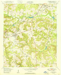
1950 · Hephzibah
USGS Topo · 1:24,000