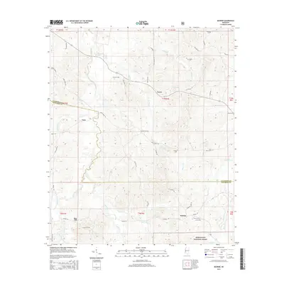
2015 Map of McBride
USGS Topo · Published 2015About this map
The boundary between Claiborne Co and Jefferson Co cuts through this rural Mississippi landscape, dominated by the northern reaches of the Homochitto National Forest. The settlement pattern is characterized by small, dispersed communities such as Violet, Peyton, and Blue Hill, with many of the local roads following the high ground between the numerous creek drainages. A dense network of family-named cemeteries, including Antioch Cem, Trevillion Cem, and Sarepta Cem, provides significant value for genealogical research in this region. The terrain is deeply dissected by watercourses like Clarks Creek, Johnson Cr, and Buckins Cr, illustrating the complex drainage systems that flow toward the Homochitto River basin. This survey documents the intersection of public forest land and private holdings along established routes like McBride Rd and Beech Grove Rd.
Find a feature on this map
59 named features on this map. Tap any name to fly to it.
Don’t see what you’re looking for? This feature index may not catch every label — zoom into the map to look around manually.
Map Details
Editions of this 2015 McBride Map
This is the sole edition of this map. No revisions or reprints were ever made.
Other maps of this area

1953 · Natchez
USGS Topo · 1:250,000

1956 · Natchez
USGS Topo · 1:250,000

1959 · Natchez
USGS Topo · 1:250,000

1963 · Port Gibson
USGS Topo · 1:24,000

1963 · Dentville NW
USGS Topo · 1:24,000

1963 · Red Lick
USGS Topo · 1:24,000

1963 · Union Church
USGS Topo · 1:62,500
1963 · Hermanville
USGS Topo · 1:24,000

1963 · McBride
USGS Topo · 1:24,000

1963 · Barlow
USGS Topo · 1:24,000