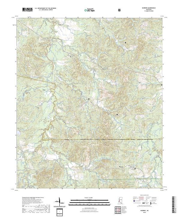
2024 Map of McBride
USGS Topo · Published 2024About this map
Homochitto National Forest anchors the southern portion of this landscape, where the border between Claiborne and Jefferson Counties bisects a terrain of dense creek networks and family cemeteries. Small settlements like McBride and Violet are connected by a web of local roads such as McBride Rd and Forest Grove Rd. This 2024 survey documents the enduring rural character of the region, where family heritage is preserved at sites like Antioch Cem and Trevillion Cem. The hydrology of the area is particularly intricate, defined by the many forks of Clarks Creek, Singleterry Creek, and Blue Gills Creek. To the north, Blue Hill rises above the surrounding valleys, providing a geographical focal point near the community of Peyton. The map offers a detailed view of the modern land divisions and access routes within the national forest and surrounding private lands.
Find a feature on this map
62 named features on this map. Tap any name to fly to it.
Don’t see what you’re looking for? This feature index may not catch every label — zoom into the map to look around manually.
Map Details
Editions of this 2024 McBride Map
This is the sole edition of this map. No revisions or reprints were ever made.
Other maps of this area

1953 · Natchez
USGS Topo · 1:250,000

1956 · Natchez
USGS Topo · 1:250,000

1959 · Natchez
USGS Topo · 1:250,000

1963 · Port Gibson
USGS Topo · 1:24,000

1963 · Dentville NW
USGS Topo · 1:24,000

1963 · Red Lick
USGS Topo · 1:24,000

1963 · Union Church
USGS Topo · 1:62,500
1963 · Hermanville
USGS Topo · 1:24,000

1963 · McBride
USGS Topo · 1:24,000

1963 · Barlow
USGS Topo · 1:24,000