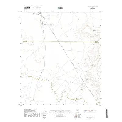
2019 Map of McCamey South
USGS Topo · Published 2019About this map
McCamey sits at the northern edge of this West Texas survey, where the southern reaches of Upton County meet the rugged transition into Crockett and Pecos counties. The landscape is defined by the winding course of the Pecos River, which carves a deep valley across the southern half of the sheet, joined by the intermittent drainage of Tunas Cr. To the north, the terrain rises toward the Bobcat Hills and the prominent Southwest Mesa, illustrating the stark topography of the Permian Basin region.
Find a feature on this map
19 named features on this map. Tap any name to fly to it.
Don’t see what you’re looking for? This feature index may not catch every label — zoom into the map to look around manually.
Map Details
Editions of this 2019 McCamey South Map
This is the sole edition of this map. No revisions or reprints were ever made.
Other maps of this area

1928 · Crane
USGS Topo · 1:125,000

1929 · Independence Draw Quadrangle
USGS Topo · 1:125,000

1954 · Pecos
USGS Topo · 1:250,000

1954 · Fort Stockton
USGS Topo · 1:250,000

1957 · Pecos
USGS Topo · 1:250,000

1958 · Fort Stockton
USGS Topo · 1:250,000

1969 · Indian Mesa
USGS Topo · 1:24,000

1969 · Bakersfield
USGS Topo · 1:24,000
1969 · Indian Mesa NE
USGS Topo · 1:24,000

1972 · Girvin NE
USGS Topo · 1:24,000