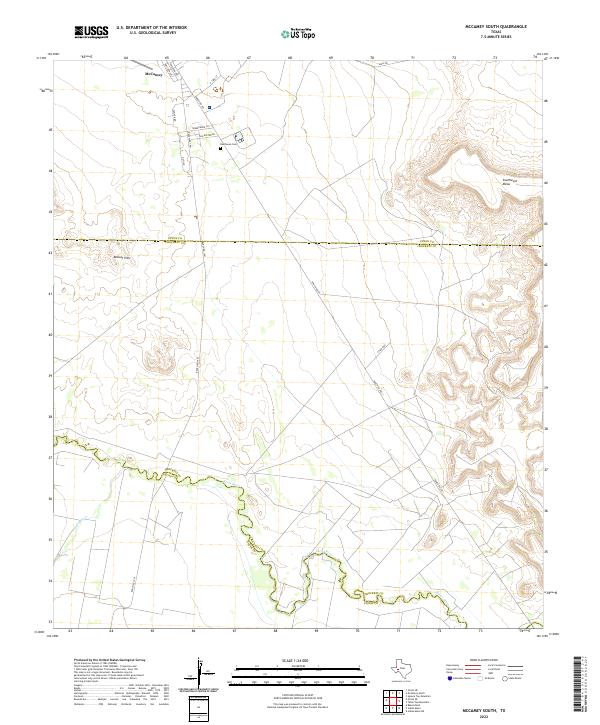
2022 Map of McCamey South
USGS Topo · Published 2022About this map
The southern edge of McCamey serves as the focal point of this West Texas study, where the residential grid of Houston Ave and Emerson Ave transitions into the high desert landscape. The terrain is defined by the significant winding course of the Pecos River, which creates a prominent boundary between Crockett and Pecos counties. To the north, the Resthaven Cem sits near the junction of Sawyer Rd and Ranch Rd 1901, marking a site of local genealogical interest. The geography is characterized by distinct elevation changes, specifically the rugged rises of the Bobcat Hills and the expansive Southwest Mesa. This area represents a crossroads of rural infrastructure, where long stretches of road like Shell Rd and Ranch Rd 305 navigate the mesas and river breaks of the Permian Basin region.
Find a feature on this map
19 named features on this map. Tap any name to fly to it.
Don’t see what you’re looking for? This feature index may not catch every label — zoom into the map to look around manually.
Map Details
Editions of this 2022 McCamey South Map
This is the sole edition of this map. No revisions or reprints were ever made.
Other maps of this area

1928 · Crane
USGS Topo · 1:125,000

1929 · Independence Draw Quadrangle
USGS Topo · 1:125,000

1954 · Pecos
USGS Topo · 1:250,000

1954 · Fort Stockton
USGS Topo · 1:250,000

1957 · Pecos
USGS Topo · 1:250,000

1958 · Fort Stockton
USGS Topo · 1:250,000

1969 · Indian Mesa
USGS Topo · 1:24,000

1969 · Bakersfield
USGS Topo · 1:24,000
1969 · Indian Mesa NE
USGS Topo · 1:24,000

1972 · Girvin NE
USGS Topo · 1:24,000