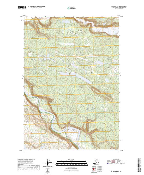
2023 Map of McCarthy B-6 SE
USGS Topo · Published 2023About this map
The Chitina River flows through the southern portion of this landscape, carving a wide valley that marks the boundary of the Wrangell-Saint Elias National Park. This 2023 survey documents the intersection of several vast protected areas, including the Wrangell-St. Elias Wilderness and the Wrangell-Saint Elias National Preserve. The terrain is characterized by a high concentration of wetlands and intricate water systems in the northern reaches, where the Nizina River skirts the top edge of the quadrangle. Interior features like Threemile Lake and Star Lake are set against a backdrop of complex contour lines, reflecting the elevation changes typical of this Alaskan wilderness region. The map provides a detailed view of the natural hydrology and land designations before any major human infrastructure, focusing on the preservation of the Copper River Census Area's natural state.
Find a feature on this map
11 named features on this map. Tap any name to fly to it.
Don’t see what you’re looking for? This feature index may not catch every label — zoom into the map to look around manually.
Map Details
Editions of this 2023 McCarthy B-6 SE Map
This is the sole edition of this map. No revisions or reprints were ever made.
Other maps of this area

1951 · McCarthy
USGS Topo · 1:250,000

1959 · McCarthy B-6
USGS Topo · 1:63,360

1959 · McCarthy B-5
USGS Topo · 1:63,360

1959 · McCarthy A-5
USGS Topo · 1:63,360

1959 · McCarthy A-6
USGS Topo · 1:63,360

1960 · McCarthy
USGS Topo · 1:250,000

1994 · McCarthy A-6
USGS Topo · 1:63,360
1994 · McCarthy B-6
USGS Topo · 1:63,360
1994 · McCarthy A-5
USGS Topo · 1:63,360
2017 · McCarthy A-5 NW
USGS Topo · 1:25,000