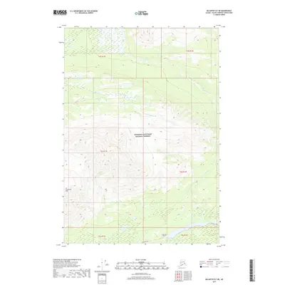
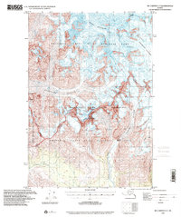
2017 Map of McCarthy B-7 NE
USGS Topo · Published 2017About this map
Wrangell-Saint Elias National Preserve encompasses most of this landscape, where the high ridges of the Crystalline Hills overlook a complex network of glacial meltwater. The drainage is dominated by the southward flow of the Lakina River and the Gilahina River, which cut through the terrain alongside smaller tributaries like Crystal Cr and Fohlin Cr. Human activity is concentrated along the southern edge of the sheet, centered on the corridor of the McCarthy Road. This vital interior artery provides the only ground access through the preserve toward the historic copper mining districts. Near the road, Long Lake and the Long Lake Airport serve as a remote transportation hub, illustrating the continued importance of bush aviation and gravel-road access in this corner of the Unorganized Borough.
Find a feature on this map
15 named features on this map. Tap any name to fly to it.
Don’t see what you’re looking for? This feature index may not catch every label — zoom into the map to look around manually.
Map Details
Editions of this 2017 McCarthy B-7 NE Map
This is the sole edition of this map. No revisions or reprints were ever made.
Other maps of this area

1951 · McCarthy
USGS Topo · 1:250,000

1959 · McCarthy B-6
USGS Topo · 1:63,360

1959 · McCarthy C-6
USGS Topo · 1:63,360

1959 · McCarthy C-7
USGS Topo · 1:63,360

1959 · McCarthy B-7
USGS Topo · 1:63,360

1960 · McCarthy
USGS Topo · 1:250,000
1993 · McCarthy C-6
USGS Topo · 1:63,360
1994 · McCarthy B-6
USGS Topo · 1:63,360
1995 · McCarthy B-7
USGS Topo · 1:63,360
1995 · McCarthy C-7
USGS Topo · 1:63,360