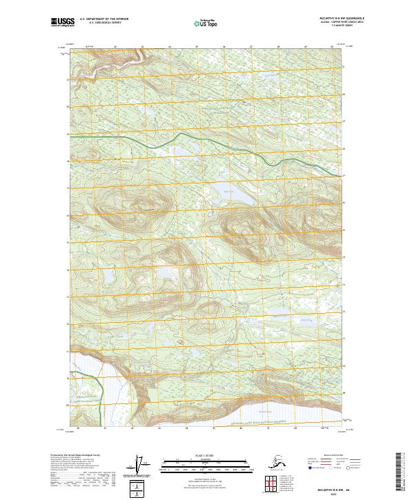
2023 Map of McCarthy B-8 NW
USGS Topo · Published 2023About this map
McCarthy Road traverses this remote interior landscape, serving as the primary corridor through the Copper River Census Area. The terrain is defined by the high prominence of Lost Butte and a complex drainage system where the Kuskulana River and Trinity River move toward their confluence with the massive Chitina River at the southern edge. This 2023 survey illustrates the overlap of multiple federal land designations, including the Wrangell-Saint Elias National Park, the Wrangell-St. Elias Wilderness, and the Wrangell-Saint Elias National Preserve. The hydrology of the area is further characterized by numerous high-latitude bodies of water such as Billy Lake, Lana Lake, and Muskrat Lake, which dot the wetlands and basins between the mountain ranges.
Find a feature on this map
18 named features on this map. Tap any name to fly to it.
Don’t see what you’re looking for? This feature index may not catch every label — zoom into the map to look around manually.
Map Details
Editions of this 2023 McCarthy B-8 NW Map
This is the sole edition of this map. No revisions or reprints were ever made.
Other maps of this area

1951 · McCarthy
USGS Topo · 1:250,000

1951 · Valdez B-1
USGS Topo · 1:63,360

1951 · McCarthy C-8
USGS Topo · 1:63,360

1951 · McCarthy B-8
USGS Topo · 1:63,360

1951 · Valdez C-1
USGS Topo · 1:63,360

1952 · Valdez
USGS Topo · 1:250,000

1953 · Valdez C-1
USGS Topo · 1:63,360

1960 · McCarthy
USGS Topo · 1:250,000

1960 · Valdez
USGS Topo · 1:250,000

1995 · McCarthy B-8
USGS Topo · 1:63,360