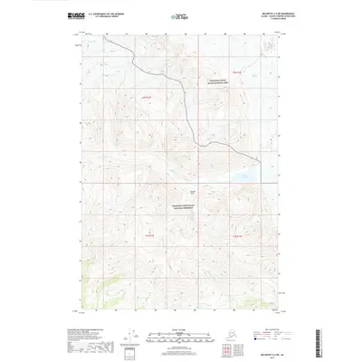
2017 Map of McCarthy C-6 SW
USGS Topo · Published 2017About this map
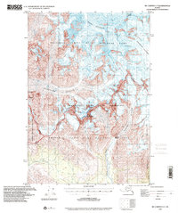
Lakina Glacier and the edge of the Kennicott Glacier dominate this 2017 high-altitude study of the Alaskan wilderness. The map documents the boundary between the Wrangell-Saint Elias National Park and the Wrangell-Saint Elias National Preserve, a division that marks different levels of resource protection and land use. The glacial landscape is deeply carved by drainage systems including Glacier Gulch and the winding course of Hidden Cr, which feeds into Hidden Cr Lake. This area of the Valdez-Cordova Census Area is characterized by its extreme elevation changes and drainage networks, such as Fohlin Cr and Fourth of July Cr, that flow from the retreating ice masses. The map provides a precise record of the ice margins and hydrologic features as they existed in the early 21st century.
Find a feature on this map
14 named features on this map. Tap any name to fly to it.
Don’t see what you’re looking for? This feature index may not catch every label — zoom into the map to look around manually.
Map Details
Editions of this 2017 McCarthy C-6 SW Map
This is the sole edition of this map. No revisions or reprints were ever made.
Other maps of this area

1951 · McCarthy
USGS Topo · 1:250,000

1959 · McCarthy B-6
USGS Topo · 1:63,360

1959 · McCarthy C-6
USGS Topo · 1:63,360

1959 · McCarthy C-7
USGS Topo · 1:63,360

1959 · McCarthy B-7
USGS Topo · 1:63,360

1960 · McCarthy
USGS Topo · 1:250,000
1993 · McCarthy C-6
USGS Topo · 1:63,360
1994 · McCarthy B-6
USGS Topo · 1:63,360
1995 · McCarthy B-7
USGS Topo · 1:63,360
1995 · McCarthy C-7
USGS Topo · 1:63,360