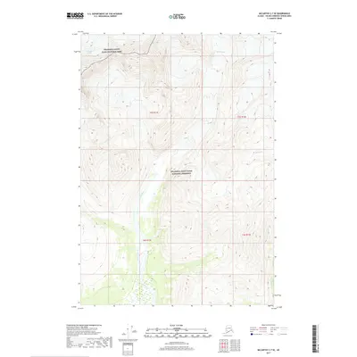
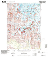
2017 Map of McCarthy C-7 SE
USGS Topo · Published 2017About this map
Wrangell-Saint Elias National Park and the adjacent Wrangell-Saint Elias National Preserve cover the vast majority of this landscape in the McCarthy region. This high-altitude wilderness is defined by its glacial activity, notably the Kuskulana Glacier in the northwest and Lakina Glacier to the northeast. These massive ice fields feed a network of drainages that carve through the steep terrain, including the headwaters of the Lakina River, which bisects the southern half of the quadrangle. Smaller tributaries like Mill Cr and Hidden Cr illustrate the intricate drainage patterns required to shed meltwater from the towering peaks. The map provides a detailed view of the natural boundary between the highly protected park lands and the preserve, reflecting modern federal land management in one of the most remote sections of Alaska.
Find a feature on this map
12 named features on this map. Tap any name to fly to it.
Don’t see what you’re looking for? This feature index may not catch every label — zoom into the map to look around manually.
Map Details
Editions of this 2017 McCarthy C-7 SE Map
This is the sole edition of this map. No revisions or reprints were ever made.
Other maps of this area

1951 · McCarthy
USGS Topo · 1:250,000

1959 · McCarthy B-6
USGS Topo · 1:63,360

1959 · McCarthy C-6
USGS Topo · 1:63,360

1959 · McCarthy C-7
USGS Topo · 1:63,360

1959 · McCarthy B-7
USGS Topo · 1:63,360

1960 · McCarthy
USGS Topo · 1:250,000
1993 · McCarthy C-6
USGS Topo · 1:63,360
1994 · McCarthy B-6
USGS Topo · 1:63,360
1995 · McCarthy B-7
USGS Topo · 1:63,360
1995 · McCarthy C-7
USGS Topo · 1:63,360