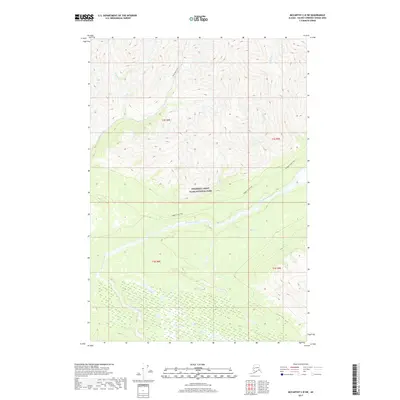
2017 Map of McCarthy C-8 SW
USGS Topo · Published 2017About this map
Wrangell-Saint Elias National Park encompasses most of this landscape, centered on the drainage of the Kuskulana River. The terrain is defined by a dense network of mountain waterways including Strelna Creek, Sheep Creek, and Clear Creek that carve through high-elevation basins. This 2017 survey details the corridors used for backcountry travel through the Copper River region, specifically identifying the Dixie Pass Trail and the Nugget Creek Trail. These routes follow natural valley contours, providing access to remote locations like Dry Creek and Squaw Creek. The map offers a precise look at the glaciated topography and hydrological patterns within America's largest national park during the early twenty-first century.
Find a feature on this map
14 named features on this map. Tap any name to fly to it.
Don’t see what you’re looking for? This feature index may not catch every label — zoom into the map to look around manually.
Map Details
Editions of this 2017 McCarthy C-8 SW Map
This is the sole edition of this map. No revisions or reprints were ever made.
Other maps of this area

1951 · McCarthy
USGS Topo · 1:250,000

1951 · Valdez B-1
USGS Topo · 1:63,360

1951 · McCarthy C-8
USGS Topo · 1:63,360

1951 · McCarthy B-8
USGS Topo · 1:63,360

1951 · Valdez C-1
USGS Topo · 1:63,360

1952 · Valdez
USGS Topo · 1:250,000

1953 · Valdez C-1
USGS Topo · 1:63,360

1960 · McCarthy
USGS Topo · 1:250,000

1960 · Valdez
USGS Topo · 1:250,000

1995 · McCarthy B-8
USGS Topo · 1:63,360