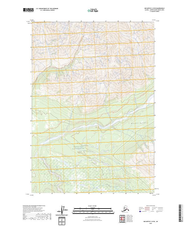
2023 Map of McCarthy C-8 SW
USGS Topo · Published 2023About this map
Wrangell-Saint Elias National Park encompasses the southern half of this landscape, where the Kuskulana River flows through a series of steep drainages. The northern portion is dominated by the high peaks of the Wrangell Mountains, characterized by high-elevation ridges and glacial valleys. A network of backcountry routes provides access through this wilderness, including the Nugget Creek Trl which follows the river course and the Dixie Pass Trl crossing the northwestern slopes. Numerous water bodies define the topography, such as Strelna Creek and Sheep Creek, which drain the massive mountain system. The map documents a contemporary state of this protected interior, illustrating the complex hydrology of Clear Creek and Dike Creek before they join the larger glacial river systems of the Copper River Census Area.
Find a feature on this map
16 named features on this map. Tap any name to fly to it.
Don’t see what you’re looking for? This feature index may not catch every label — zoom into the map to look around manually.
Map Details
Editions of this 2023 McCarthy C-8 SW Map
This is the sole edition of this map. No revisions or reprints were ever made.
Other maps of this area

1951 · McCarthy
USGS Topo · 1:250,000

1951 · Valdez B-1
USGS Topo · 1:63,360

1951 · McCarthy C-8
USGS Topo · 1:63,360

1951 · McCarthy B-8
USGS Topo · 1:63,360

1951 · Valdez C-1
USGS Topo · 1:63,360

1952 · Valdez
USGS Topo · 1:250,000

1953 · Valdez C-1
USGS Topo · 1:63,360

1960 · McCarthy
USGS Topo · 1:250,000

1960 · Valdez
USGS Topo · 1:250,000

1995 · McCarthy B-8
USGS Topo · 1:63,360