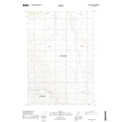
2017 Map of McCarthy D-3 NW
USGS Topo · Published 2017About this map
Wrangell-Saint Elias National Park and the adjacent Wrangell-Saint Elias National Preserve cover the vast majority of this wilderness expanse in the Valdez-Cordova region. This 2017 survey documents a high-altitude landscape defined by glaciation and alpine drainage systems, most notably the Lime Glacier in the southwestern corner. The map traces the paths of Geohenda Creek and Bow Creek, which serve as the primary hydrologic features through these township boundaries. The lack of infrastructure, roads, or named settlements highlights the protected status of these lands, where the natural topography remains the dominant focus of the survey. The relationship between the park and preserve boundaries is clearly delineated across the high-relief terrain, providing a look at the federal management lines within this remote section of the Alaskan interior.
Find a feature on this map
13 named features on this map. Tap any name to fly to it.
Don’t see what you’re looking for? This feature index may not catch every label — zoom into the map to look around manually.
Map Details
Editions of this 2017 McCarthy D-3 NW Map
This is the sole edition of this map. No revisions or reprints were ever made.
Other maps of this area

1950 · Nabesna
USGS Topo · 1:250,000

1951 · McCarthy
USGS Topo · 1:250,000

1951 · Nabesna
USGS Topo · 1:250,000

1959 · McCarthy D-3
USGS Topo · 1:63,360

1960 · Nabesna A-3
USGS Topo · 1:63,360

1960 · Nabesna A-2
USGS Topo · 1:63,360

1960 · Nabesna
USGS Topo · 1:250,000

1960 · McCarthy D-4
USGS Topo · 1:63,360

1960 · McCarthy
USGS Topo · 1:250,000
2016 · Nabesna A-3 SE
USGS Topo · 1:25,000