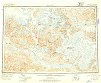
1951 Map of McCarthy
USGS Topo · Published 1954About this map
McCarthy serves as the primary outpost in this 1951 topographic survey of the eastern Wrangell Mountains. The landscape is dominated by massive ice fields and drainage systems, including the Kennicott Glacier, which feeds into the Nizina River. To the west, the Kuskulana River and Kotsina River carve through high peaks like Mount Blackburn and Castle Peak. Transportation in this remote Alaskan interior is defined by air and foot, with the McCarthy Airstrip and Bremner Airstrip providing access points, while the Skolai Trail offers a terrestrial route through the high passes near Castle Mountain. The convergence of the Chitina River and the Tana River highlights the complex hydrology of the region. Notable summits such as Bonanza Peak and Sourdough Peak stand near the settlement, reflecting the area's prospecting history, while the international boundary with the Yukon Territory and Canada is marked along the massive Klutlan Glacier.
Find a feature on this map
142 named features on this map. Tap any name to fly to it.
Don’t see what you’re looking for? This feature index may not catch every label — zoom into the map to look around manually.
Map Details
Editions of this 1951 McCarthy Map
4 editions found
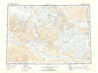
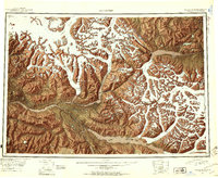
Other maps of this area

1948 · Cordova
USGS Topo · 1:250,000

1950 · Nabesna
USGS Topo · 1:250,000

1950 · McCarthy A-8
USGS Topo · 1:63,360

1950 · Bering Glacier
USGS Topo · 1:250,000

1951 · McCarthy
USGS Topo · 1:250,000

1951 · Gulkana
USGS Topo · 1:250,000

1951 · Bering Glacier
USGS Topo · 1:250,000

1951 · Nabesna
USGS Topo · 1:250,000

1951 · Cordova
USGS Topo · 1:250,000

1951 · Mt Saint Elias
USGS Topo · 1:250,000