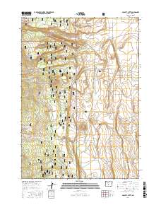
2017 Map of McCarty Butte
USGS Topo · Published 2017About this map
McCarty Butte rises above a high-desert landscape defined by the intersection of the Fremont National Forest and Deschutes National Forest. This remote section of Lake County is characterized by a complex network of forest development roads and BLM access routes that crisscross the arid terrain. Water management is a primary feature of the area's development, evidenced by the presence of Lasater Reservoir, Wastina Pond, and isolated water sources like Gubsher Well. These features, along with seasonal drainages such as Dry Creek and Smoke Cr, indicate a landscape where resource management is critical for land use. The map also reveals the flatlands of Sears Flat, which break the volcanic topography of the high interior plateau.
Find a feature on this map
26 named features on this map. Tap any name to fly to it.
Don’t see what you’re looking for? This feature index may not catch every label — zoom into the map to look around manually.
Map Details
Editions of this 2017 McCarty Butte Map
This is the sole edition of this map. No revisions or reprints were ever made.
Other maps of this area

1955 · Crescent
USGS Topo · 1:250,000

1957 · Crescent
USGS Topo · 1:250,000

1958 · Crescent
USGS Topo · 1:250,000

1968 · Silver Lake
USGS Topo · 1:24,000

1968 · Oatman Flat
USGS Topo · 1:24,000
1968 · Antelope Mtn
USGS Topo · 1:24,000

1970 · Crescent
USGS Topo · 1:250,000

1979 · Crescent
USGS Topo · 1:100,000
1981 · Wickiup Spring
USGS Topo · 1:24,000
1981 · Fort Rock
USGS Topo · 1:24,000