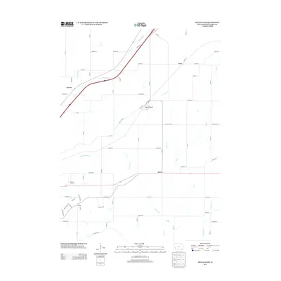
2013 Map of McClelland
USGS Topo · Published 2013About this map
McClelland sits at the center of this rural landscape, where a grid of farm-to-market roads meets the convergence of small drainage basins in Pottawattamie County. The map documents a predominantly agricultural area characterized by the winding paths of Mosquito Cr and Little Mosquito Cr, which contrast with the sharp geometric lines of local thoroughfares like McClelland Ave and Idlewood Rd. Small settlements such as Weston and Quick anchor different corners of the sheet, while the Westfair Fairground serves as a notable regional landmark. The drainage patterns of Little Keg Cr and Keg Cr reveal the rolling nature of the Iowa countryside, where every mile or half-mile is often marked by a named road, reflecting the systematic land division that defines the Midwest. This 2013 survey provides a clear look at the contemporary infrastructure and water systems of the region.
Find a feature on this map
61 named features on this map. Tap any name to fly to it.
Don’t see what you’re looking for? This feature index may not catch every label — zoom into the map to look around manually.
Map Details
Editions of this 2013 McClelland Map
This is the sole edition of this map. No revisions or reprints were ever made.
Other maps of this area

1893 · Omaha
USGS Topo · 1:62,500

1954 · Omaha
USGS Topo · 1:250,000

1956 · Underwood
USGS Topo · 1:24,000

1956 · Mineola
USGS Topo · 1:24,000

1956 · Council Bluffs North
USGS Topo · 1:24,000

1956 · Neola
USGS Topo · 1:24,000

1956 · Treynor
USGS Topo · 1:24,000

1956 · Mc Clelland
USGS Topo · 1:24,000

1956 · Council Bluffs South
USGS Topo · 1:24,000

1957 · Omaha
USGS Topo · 1:250,000