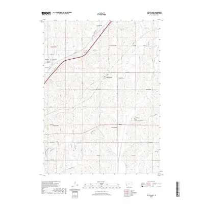
2018 Map of McClelland
USGS Topo · Published 2018About this map
McClelland and Underwood anchor this survey of rural Pottawattamie County, Iowa, showcasing a landscape defined by the drainage networks of Mosquito Creek and Keg Cr. The map captures a transition from traditional agricultural corridors to more modern residential patterns, yet it remains firmly rooted in local history. Genealogists will find significant value in the documentation of early burial grounds, including the Downsville Cem and the Pottawattamie County Home Cem, the latter situated near the community of McClelland.
Find a feature on this map
61 named features on this map. Tap any name to fly to it.
Don’t see what you’re looking for? This feature index may not catch every label — zoom into the map to look around manually.
Map Details
Editions of this 2018 McClelland Map
This is the sole edition of this map. No revisions or reprints were ever made.
Other maps of this area

1893 · Omaha
USGS Topo · 1:62,500

1954 · Omaha
USGS Topo · 1:250,000

1956 · Underwood
USGS Topo · 1:24,000

1956 · Mineola
USGS Topo · 1:24,000

1956 · Council Bluffs North
USGS Topo · 1:24,000

1956 · Neola
USGS Topo · 1:24,000

1956 · Treynor
USGS Topo · 1:24,000

1956 · Mc Clelland
USGS Topo · 1:24,000

1956 · Council Bluffs South
USGS Topo · 1:24,000

1957 · Omaha
USGS Topo · 1:250,000