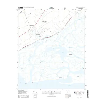
2014 Map of McClellanville
USGS Topo · Published 2014About this map
McClellanville serves as the focal point of this coastal landscape, situated where the Atlantic marshlands meet the dense timber of the Francis Marion National Forest. The map illustrates a complex network of tidewater passages, including Mathews Cut, Town Creek, and the Intracoastal Waterway, which define the low-lying geography of the Santee Delta region. Inland, the town’s grid extends along streets like Drayton St and Lincoln Rd, while the McClellanville Lookout Tower stands as a prominent local landmark. The transition from the settled areas at Moores Corner to the wilderness of Raccoon Key and Lighthouse Island reflects the area's dual character as both a working waterfront and a protected natural preserve. Navigational features like Key Inlet and Slack Reach provide insights into the maritime routes used by local fishermen and boaters navigating the labyrinthine creeks and bays.
Find a feature on this map
55 named features on this map. Tap any name to fly to it.
Don’t see what you’re looking for? This feature index may not catch every label — zoom into the map to look around manually.
Map Details
Editions of this 2014 McClellanville Map
This is the sole edition of this map. No revisions or reprints were ever made.
Other maps of this area

1919 · Bulls Island
USGS Topo · 1:21,120

1942 · Cape Romain
USGS Topo · 1:24,000

1942 · Mc Clellanville
USGS Topo · 1:24,000

1942 · Honey Hill
USGS Topo · 1:24,000

1943 · Bulls Island
USGS Topo · 1:24,000

1943 · Santee
USGS Topo · 1:24,000

1943 · Awendaw
USGS Topo · 1:24,000

1943 · Minim Island
USGS Topo · 1:24,000

1948 · James Island
USGS Topo · 1:250,000

1949 · Georgetown
USGS Topo · 1:250,000