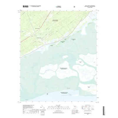
2020 Map of McClellanville
USGS Topo · Published 2020About this map
The coastal village of McClellanville sits at the edge of a complex network of maritime forests and salt marshes, defined by its historic connection to the water. This 2020 landscape shows the town's residential core organized along Scotia St, Oak St, and Romain Rd, buffered to the north by the extensive Francis Marion National Forest. The geography is dominated by the Intracoastal Waterway and the expansive reaches of the Cape Romain National Wildlife Refuge, where a labyrinth of tidal channels like Town Creek and Five Fathom Creek separate the mainland from Jeremy Island and Raccoon Key. Coastal navigation and ecological preservation are the primary themes here, as seen in the protected barrier features of Sandy Point Beach and the remote Lighthouse Island facing the Atlantic Ocean. The settlement pattern at Moores Corner and the path of the Old Georgetown Rd reflect the older overland routes that once linked this fishing and agricultural community to the wider Lowcountry.
Find a feature on this map
60 named features on this map. Tap any name to fly to it.
Don’t see what you’re looking for? This feature index may not catch every label — zoom into the map to look around manually.
Map Details
Editions of this 2020 McClellanville Map
This is the sole edition of this map. No revisions or reprints were ever made.
Other maps of this area

1919 · Bulls Island
USGS Topo · 1:21,120

1942 · Cape Romain
USGS Topo · 1:24,000

1942 · Mc Clellanville
USGS Topo · 1:24,000

1942 · Honey Hill
USGS Topo · 1:24,000

1943 · Bulls Island
USGS Topo · 1:24,000

1943 · Santee
USGS Topo · 1:24,000

1943 · Awendaw
USGS Topo · 1:24,000

1943 · Minim Island
USGS Topo · 1:24,000

1948 · James Island
USGS Topo · 1:250,000

1949 · Georgetown
USGS Topo · 1:250,000