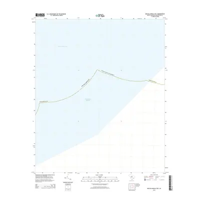
2014 Map of McClellanville OE S
USGS Topo · Published 2014About this map
Intracoastal Waterway transit routes and maritime boundaries define this coastal area of Charleston County during the early 21st century. The map focuses on the littoral interface where the protected inland navigation channel parallels the open waters of the Atlantic Ocean. As a offshore quadrangle, the sheet serves as a primary record of jurisdictional limits, including the territorial boundaries of South Carolina and the United States of America. The absence of terrestrial landmarks emphasizes the nautical focus of this survey, detailing the precise positioning of the shoreline and the waterway infrastructure essential to the region's maritime economy and navigation history.
Find a feature on this map
5 named features on this map. Tap any name to fly to it.
Don’t see what you’re looking for? This feature index may not catch every label — zoom into the map to look around manually.
Map Details
Editions of this 2014 McClellanville OE S Map
This is the sole edition of this map. No revisions or reprints were ever made.
Other maps of this area

1919 · Bulls Island
USGS Topo · 1:21,120

1942 · Cape Romain
USGS Topo · 1:24,000

1942 · Mc Clellanville
USGS Topo · 1:24,000

1943 · Bulls Island
USGS Topo · 1:24,000

1943 · Awendaw
USGS Topo · 1:24,000

1948 · James Island
USGS Topo · 1:250,000

1949 · Georgetown
USGS Topo · 1:250,000
1959 · Bull Island
USGS Topo · 1:24,000

1967 · Georgetown
USGS Topo · 1:250,000
1968 · James Island
USGS Topo · 1:250,000