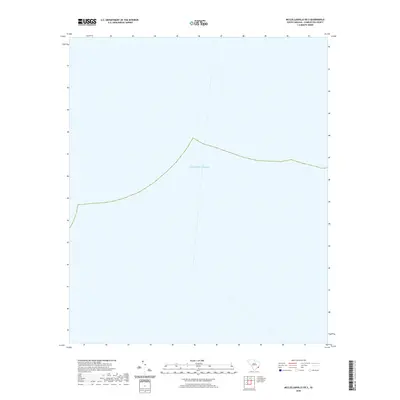
2020 Map of McClellanville OE S
USGS Topo · Published 2020About this map
The vast expanse of the Atlantic Ocean dominates this offshore survey from 2020. Located off the coast of Charleston County, South Carolina, this maritime sheet serves as a clear indicator of the state's shelf waters. While terrestrial features are absent, the map illustrates the coastal boundary and the maritime reaches associated with the McClellanville area, focusing on the hydrography and jurisdictional boundaries of the Lowcountry shoreline.
Find a feature on this map
1 named feature on this map. Tap any name to fly to it.
Don’t see what you’re looking for? This feature index may not catch every label — zoom into the map to look around manually.
Map Details
Editions of this 2020 McClellanville OE S Map
This is the sole edition of this map. No revisions or reprints were ever made.
Other maps of this area

1919 · Bulls Island
USGS Topo · 1:21,120

1942 · Cape Romain
USGS Topo · 1:24,000

1942 · Mc Clellanville
USGS Topo · 1:24,000

1943 · Bulls Island
USGS Topo · 1:24,000

1943 · Awendaw
USGS Topo · 1:24,000

1948 · James Island
USGS Topo · 1:250,000

1949 · Georgetown
USGS Topo · 1:250,000
1959 · Bull Island
USGS Topo · 1:24,000

1967 · Georgetown
USGS Topo · 1:250,000
1968 · James Island
USGS Topo · 1:250,000