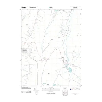
2010 Map of McConnellsburg
USGS Topo · Published 2010About this map
McConnellsburg and the surrounding Ridge and Valley landscape of Franklin County are defined by sharp topographic divides and historic mountain passes. The terrain is marked by the long spine of Little Scrub Ridge and the heights of Big Mountain, which funnel travel through prominent gaps like Tuscarora Summit and Buchanan Summit. To the north, Cowans Gap State Park surrounds Cowans Gap Lake, a significant recreational area near the small settlement of Cowans Village.
Find a feature on this map
77 named features on this map. Tap any name to fly to it.
Don’t see what you’re looking for? This feature index may not catch every label — zoom into the map to look around manually.
Map Details
Editions of this 2010 McConnellsburg Map
This is the sole edition of this map. No revisions or reprints were ever made.
Other maps of this area

1900 · Mercersburg
USGS Topo · 1:62,500

1902 · Mercersburg
USGS Topo · 1:62,500

1925 · Needmore
USGS Topo · 1:48,000

1930 · Broad Top
USGS Topo · 1:62,500

1933 · Broad Top
USGS Topo · 1:62,500

1935 · Needmore
USGS Topo · 1:62,500

1939 · Needmore
USGS Topo · 1:62,500

1939 · Orbisonia
USGS Topo · 1:62,500

1940 · Orbisonia
USGS Topo · 1:62,500

1942 · Hagerstown
USGS Topo · 1:125,000