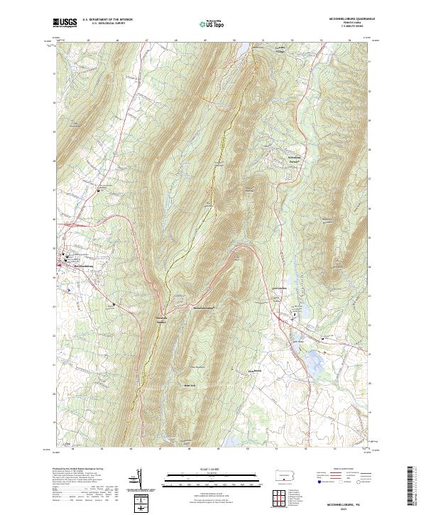
2023 Map of McConnellsburg
USGS Topo · Published 2023About this map
McConnellsburg and Fort Loudon serve as the primary hubs in this region where the ridges of the Appalachian Mountains create a corridor of narrow valleys and high gaps. The transition from Fulton and Franklin Counties is marked by the imposing spine of Tuscarora Mountain, which separates the settlement of McConnellsburg in the west from the Path Valley to the east. Local history is deeply embedded in the landscape through numerous burial sites, including the Magsam Family Cem and the Old Reformed and Lutheran Church Cem near Fort Loudon.
Find a feature on this map
118 named features on this map. Tap any name to fly to it.
Don’t see what you’re looking for? This feature index may not catch every label — zoom into the map to look around manually.
Map Details
Editions of this 2023 McConnellsburg Map
This is the sole edition of this map. No revisions or reprints were ever made.
Other maps of this area

1900 · Mercersburg
USGS Topo · 1:62,500

1902 · Mercersburg
USGS Topo · 1:62,500

1925 · Needmore
USGS Topo · 1:48,000

1930 · Broad Top
USGS Topo · 1:62,500

1933 · Broad Top
USGS Topo · 1:62,500

1935 · Needmore
USGS Topo · 1:62,500

1939 · Needmore
USGS Topo · 1:62,500

1939 · Orbisonia
USGS Topo · 1:62,500

1940 · Orbisonia
USGS Topo · 1:62,500

1942 · Hagerstown
USGS Topo · 1:125,000