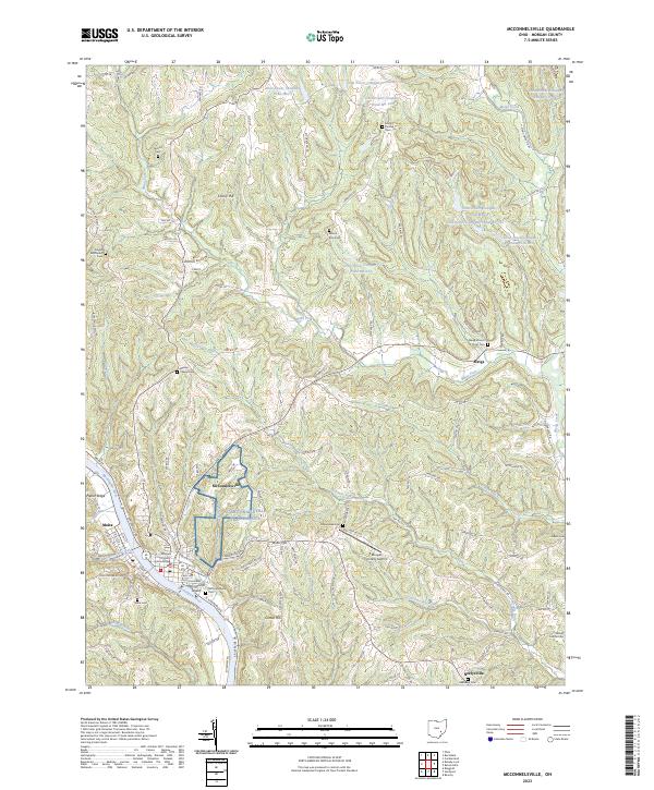
2023 Map of McConnelsville
USGS Topo · Published 2023About this map
The Muskingum River flows centrally through this 2023 survey, dividing the village of McConnelsville from its neighbor Malta on the west bank. This riverfront landscape is defined by its administrative and historical hubs, notably the Morgan County Courthouse and the nearby McConnells Island. The map reveals a complex water management history in the surrounding hills, where numerous industrial impoundments like Ohio Power Company Pond Mb-118 and Ohio Power Company Pond Mb-1 are scattered across the terrain.
Find a feature on this map
122 named features on this map. Tap any name to fly to it.
Don’t see what you’re looking for? This feature index may not catch every label — zoom into the map to look around manually.
Map Details
Editions of this 2023 McConnelsville Map
This is the sole edition of this map. No revisions or reprints were ever made.
Other maps of this area

1909 · Caldwell
USGS Topo · 1:62,500

1910 · Philo
USGS Topo · 1:62,500

1910 · Mc Connelsville
USGS Topo · 1:62,500

1911 · Cumberland
USGS Topo · 1:62,500

1912 · Caldwell
USGS Topo · 1:62,500

1949 · Clarksburg
USGS Topo · 1:250,000

1956 · Clarksburg
USGS Topo · 1:250,000

1961 · Clarksburg
USGS Topo · 1:250,000
1961 · Beverly
USGS Topo · 1:24,000

1961 · Mc Connelsville
USGS Topo · 1:24,000