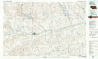
1979 Map of McCook
USGS Topo · Published 1979About this map
The Republican River valley defines the character of southwest Nebraska in the late 1970s, serving as the primary corridor for both the Burlington Northern railroad and major highways. This survey illustrates an intensive agricultural landscape supported by an intricate network of irrigation, including the Riverside Canal, Meeker Canal, and Culbertson Extension Canal. These systems feed the lands surrounding established rail towns like Culbertson, Indianola, and Cambridge.
Find a feature on this map
70 named features on this map. Tap any name to fly to it.
Don’t see what you’re looking for? This feature index may not catch every label — zoom into the map to look around manually.
Map Details
Editions of this 1979 McCook Map
This is the sole edition of this map. No revisions or reprints were ever made.
Other maps of this area

1893 · Norton
USGS Topo · 1:125,000

1896 · Lexington
USGS Topo · 1:125,000

1896 · Arapahoe
USGS Topo · 1:125,000

1898 · Arapahoe
USGS Topo · 1:125,000

1899 · Lexington
USGS Topo · 1:125,000

1902 · Gothenburg
USGS Topo · 1:125,000

1951 · Norton
USGS Topo · 1:62,500

1951 · Herndon
USGS Topo · 1:62,500

1951 · Atwood
USGS Topo · 1:62,500

1951 · Norcatur
USGS Topo · 1:62,500