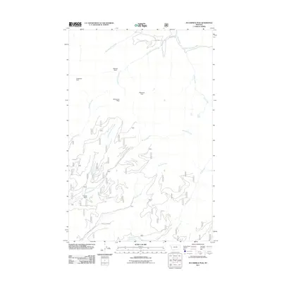
2011 Map of McCormick Peak
USGS Topo · Published 2011About this map
McCormick Peak and Josephine Peak anchor the high ground of this Missoula County landscape, where complex drainage networks define the terrain. The northern reaches are dominated by the branching forks of Revais Creek, including the West Fork Revais Creek and Middle Fork Revais Creek, which carve through the high elevations near Blacktail Basin. In the southern half, the land falls toward the headwaters of McCormick Creek and its tributary, Little McCormick Creek. This area shows a transition from high-altitude features like Blackrock Peak to more sheltered areas such as Favorite Gulch. Apart from Kennedy Creek Dr in the south, the map indicates a predominantly wild mountain environment, characterized by the intricate relationship between its summits and the many creeks, such as Butler Creek and Stony Creek, that drain the slopes.
Find a feature on this map
16 named features on this map. Tap any name to fly to it.
Don’t see what you’re looking for? This feature index may not catch every label — zoom into the map to look around manually.
Map Details
Editions of this 2011 McCormick Peak Map
This is the sole edition of this map. No revisions or reprints were ever made.
Other maps of this area

1956 · Wallace
USGS Topo · 1:250,000

1959 · Tarkio
USGS Topo · 1:62,500

1959 · Alberton
USGS Topo · 1:62,500

1959 · Perma
USGS Topo · 1:62,500

1960 · Wallace
USGS Topo · 1:250,000

1964 · Dixon
USGS Topo · 1:24,000

1964 · Mc Donald
USGS Topo · 1:24,000
1983 · Stark South
USGS Topo · 1:24,000

1984 · Stark North
USGS Topo · 1:24,000
1984 · Huson
USGS Topo · 1:24,000