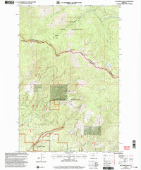
1999 Map of Mccormick Peak
USGS Topo · Published 2003About this map
Flathead Indian Reservation lands dominate the northern half of this landscape, partitioned from the Lolo National Forest by the prominent Reservation Divide. This ridge-line boundary also serves as the border between Sanders and Missoula counties, connecting high points such as Josephine Peak and McCormick Peak. The terrain is deeply carved by the drainage networks of McCormick Creek, Revals Creek, and the various forks of the Middle Fork river system.
Find a feature on this map
24 named features on this map. Tap any name to fly to it.
Don’t see what you’re looking for? This feature index may not catch every label — zoom into the map to look around manually.
Map Details
Editions of this 1999 Mccormick Peak Map
This is the sole edition of this map. No revisions or reprints were ever made.
Other maps of this area

1956 · Wallace
USGS Topo · 1:250,000

1959 · Tarkio
USGS Topo · 1:62,500

1959 · Alberton
USGS Topo · 1:62,500

1959 · Perma
USGS Topo · 1:62,500

1960 · Wallace
USGS Topo · 1:250,000

1964 · Dixon
USGS Topo · 1:24,000

1964 · Mc Donald
USGS Topo · 1:24,000
1983 · Stark South
USGS Topo · 1:24,000

1984 · Stark North
USGS Topo · 1:24,000
1984 · Huson
USGS Topo · 1:24,000