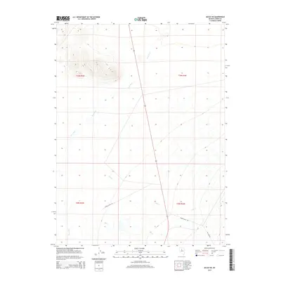
2014 Map of McCoy NE
USGS Topo · Published 2014About this map
Filippini Ranch Rd and Martin Ranch Rd anchor the interior of this high-desert landscape, tracing routes through the Great Basin terrain of Lander County. In the early 21st century, the drainage of the Reese River remains the dominant hydrological feature, moving northward through the western half of the quadrangle. The map captures a transition from the river valley into the foothills, where seasonal watercourses like Trout Cr and Mill Cr descend from higher elevations. These waterways and the corresponding Mill Creek Rd reflect a landscape organized around ranching access and the sparse water resources of the Nevada desert. The grid of township and range lines, such as t30n r43e and t29n r44e, provides a structural view of how this rural area was partitioned and managed.
Find a feature on this map
10 named features on this map. Tap any name to fly to it.
Don’t see what you’re looking for? This feature index may not catch every label — zoom into the map to look around manually.
Map Details
Editions of this 2014 McCoy NE Map
This is the sole edition of this map. No revisions or reprints were ever made.
Other maps of this area

1932 · Sonoma Range
USGS Topo · 1:250,000

1939 · Sonoma Range
USGS Topo · 1:250,000

1940 · Antler Peak
USGS Topo · 1:62,500

1943 · Antler Peak
USGS Topo · 1:62,500

1949 · Mt. Lewis
USGS Topo · 1:62,500

1950 · Mt. Lewis
USGS Topo · 1:62,500

1955 · Winnemucca
USGS Topo · 1:250,000

1957 · Battle Mountain
USGS Topo · 1:62,500

1958 · Winnemucca
USGS Topo · 1:250,000

1961 · McCoy
USGS Topo · 1:62,500