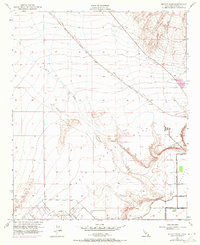
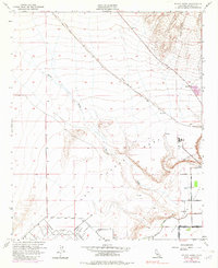
1951 Map of McCoy Wash
USGS Topo · Published 1971About this map
The arid landscape of the Palo Verde Mesa is defined by the convergence of desert drainage systems and mid-century agricultural infrastructure. The wide, braided channel of McCoy Wash dominates the central topography, flowing southeast toward the fertile valley floor. In the lower reaches of the map, the development of the Palo Verde Irrigation Canal and Drain 2 highlights the intensive effort to manage water in the Colorado River basin, transforming desert land into arable plots organized by a rigid grid of roads like 6th Ave and Arrowhead Blvd.
Find a feature on this map
21 named features on this map. Tap any name to fly to it.
Don’t see what you’re looking for? This feature index may not catch every label — zoom into the map to look around manually.
Map Details
Editions of this 1951 McCoy Wash Map
6 editions found
Other maps of this area

1942 · Blythe
USGS Topo · 1:250,000

1945 · Big Maria Mtns
USGS Topo · 1:62,500

1945 · Midland
USGS Topo · 1:62,500

1951 · Big Maria Mts
USGS Topo · 1:62,500

1951 · Blythe
USGS Topo · 1:24,000

1951 · McCoy Wash
USGS Topo · 1:24,000

1951 · Blythe NE
USGS Topo · 1:24,000

1952 · Midland
USGS Topo · 1:62,500

1952 · Mc Coy Spring
USGS Topo · 1:62,500

1952 · Ripley
USGS Topo · 1:24,000