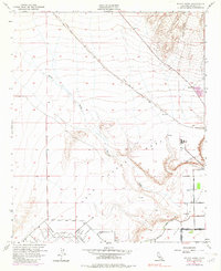
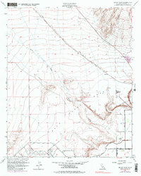
1951 Map of McCoy Wash
USGS Topo · Published 1982About this map
Mesaville sits at the edge of the Palo Verde Mesa in this desert landscape, where civil engineering projects attempted to manage the seasonal flows of McCoy Wash. The topography is dominated by the sprawling alluvial fan and a complex network of protective infrastructure, including a Diversion Dike and various levees designed to steer runoff away from the growing agricultural and transportation hubs. To the south, the Blythe Airport and the planned grid of the Palo Verde Canal system illustrate the mid-century transformation of the Colorado River valley into a productive zone.
Find a feature on this map
18 named features on this map. Tap any name to fly to it.
Don’t see what you’re looking for? This feature index may not catch every label — zoom into the map to look around manually.
Map Details
Editions of this 1951 McCoy Wash Map
6 editions found
Other maps of this area

1942 · Blythe
USGS Topo · 1:250,000

1945 · Big Maria Mtns
USGS Topo · 1:62,500

1945 · Midland
USGS Topo · 1:62,500

1951 · Big Maria Mts
USGS Topo · 1:62,500

1951 · Blythe
USGS Topo · 1:24,000

1951 · McCoy Wash
USGS Topo · 1:24,000

1951 · Blythe NE
USGS Topo · 1:24,000

1952 · Midland
USGS Topo · 1:62,500

1952 · Mc Coy Spring
USGS Topo · 1:62,500

1952 · Ripley
USGS Topo · 1:24,000