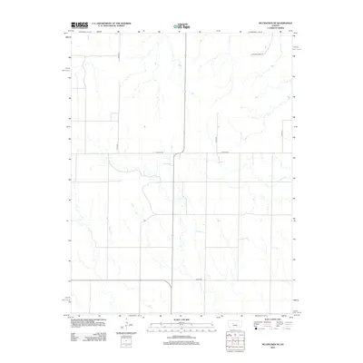
2012 Map of McCracken NE
USGS Topo · Published 2012About this map
Snake Cr meanders through the central and western reaches of this Ellis County landscape, defining the local drainage patterns in an area characterized by wide agrarian expanses and a strict section-line road network. The map reveals a transition into the 2010s where rural infrastructure is clearly delineated by corridors such as Co Hwy 587 and S Co Line Rd. This survey provides a precise look at the land's organization, where naming conventions like Chetolah Gold Rd hint at the local history of the region. The sparse distribution of named features emphasizes the open, agricultural character of the territory, centered on a series of North-South avenues including 100th Ave and 130th Ave.
Find a feature on this map
7 named features on this map. Tap any name to fly to it.
Don’t see what you’re looking for? This feature index may not catch every label — zoom into the map to look around manually.
Map Details
Editions of this 2012 McCracken NE Map
This is the sole edition of this map. No revisions or reprints were ever made.
Other maps of this area

1893 · Ellis
USGS Topo · 1:125,000

1896 · Hays
USGS Topo · 1:125,000

1955 · Great Bend
USGS Topo · 1:250,000

1957 · Great Bend
USGS Topo · 1:250,000

1958 · Great Bend
USGS Topo · 1:250,000

1961 · Antonino
USGS Topo · 1:24,000

1965 · Mc Cracken
USGS Topo · 1:24,000

1966 · Mc Cracken SW
USGS Topo · 1:24,000

1966 · Hargrave
USGS Topo · 1:24,000
1968 · La Crosse NW
USGS Topo · 1:24,000