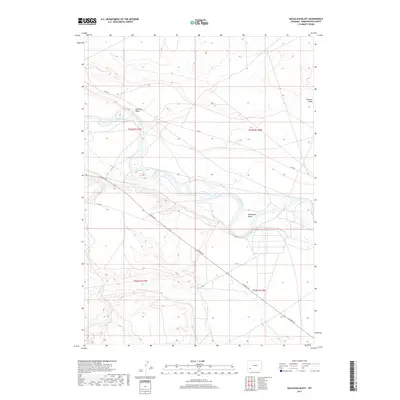
2017 Map of McCullen Bluff
USGS Topo · Published 2017About this map
The Green River meanders through the arid topography of Sweetwater County in this 2017 study, creating the prominent Horseshoe Bend as it flows south. To the north, McCullen Bluff stands as a significant vertical landmark above the river valley. The landscape is defined by the intersection of natural drainage and human transit, where Shute Cr and Fourmile Gulch carve through the high plains. The area is intersected by several essential routes for local navigation and resource access, including La Barge Rd, Co Rd 8, and Co Rd 86. This map provides a look at the sparse, high-altitude drainage patterns of the region, illustrating how the river remains the central artery for this part of southwestern Wyoming.
Find a feature on this map
12 named features on this map. Tap any name to fly to it.
Don’t see what you’re looking for? This feature index may not catch every label — zoom into the map to look around manually.
Map Details
Editions of this 2017 McCullen Bluff Map
This is the sole edition of this map. No revisions or reprints were ever made.
Other maps of this area

1954 · Ogden
USGS Topo · 1:250,000

1954 · Rock Springs
USGS Topo · 1:250,000

1955 · Preston
USGS Topo · 1:250,000

1955 · Lander
USGS Topo · 1:250,000

1958 · Lander
USGS Topo · 1:250,000

1958 · Ogden
USGS Topo · 1:250,000

1958 · Rock Springs
USGS Topo · 1:250,000

1958 · Preston
USGS Topo · 1:250,000

1960 · Ogden
USGS Topo · 1:250,000

1961 · Lander
USGS Topo · 1:250,000