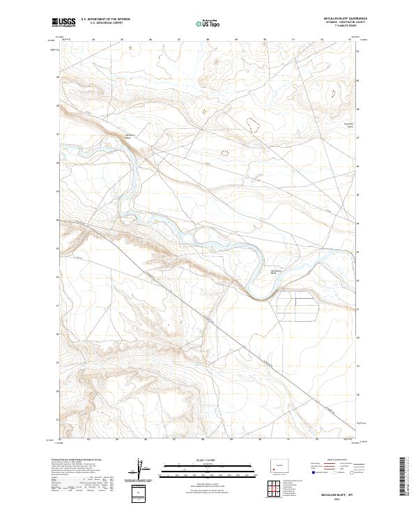
2021 Map of McCullen Bluff
USGS Topo · Published 2021About this map
Green River carves a winding path through the high desert of Sweetwater County, creating the distinctive Horseshoe Bend south of the prominent McCullen Bluff. This modern topography reflects the stark, arid landscape where drainage patterns like Shute Cr and Fourmile Gulch meet the river valley. The map documents a sparse but vital transportation network, notably La Barge Rd and Co Rd 8, which navigate the elevation changes between the river basin and the surrounding bluffs. The grid system defined by t23n r111w and neighboring townships illustrates the orderly division of this expansive Wyoming territory, where the land remains largely open and defined by its natural watercourses and geological formations.
Find a feature on this map
12 named features on this map. Tap any name to fly to it.
Don’t see what you’re looking for? This feature index may not catch every label — zoom into the map to look around manually.
Map Details
Editions of this 2021 McCullen Bluff Map
This is the sole edition of this map. No revisions or reprints were ever made.
Other maps of this area

1954 · Ogden
USGS Topo · 1:250,000

1954 · Rock Springs
USGS Topo · 1:250,000

1955 · Preston
USGS Topo · 1:250,000

1955 · Lander
USGS Topo · 1:250,000

1958 · Lander
USGS Topo · 1:250,000

1958 · Ogden
USGS Topo · 1:250,000

1958 · Rock Springs
USGS Topo · 1:250,000

1958 · Preston
USGS Topo · 1:250,000

1960 · Ogden
USGS Topo · 1:250,000

1961 · Lander
USGS Topo · 1:250,000