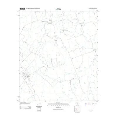
2012 Map of McDade
USGS Topo · Published 2012About this map
The settlement of McDade serves as the focal point in this 2012 survey, situated along the southwestern rail and road corridor. This pocket of Central Texas is defined by its deep genealogical roots, visible in the cluster of burial grounds north of the main settlement, including both New Knobbs Springs Cem and Old Knobbs Springs Cem near the community of Knobbs Springs. The landscape is characterized by its drainage network, where W Yegua Cr and Paint Cr carve through the terrain beneath local elevations like The Knobbs and Yegua Knobbs. Rural life is etched into the map through numerous ranch roads such as Edmonson Ranch Rd and Private Road 3071, which connect isolated homesteads and cemeteries like Sanders Cem and High Hill Cem to the primary transit lines of Old Hwy 20.
Find a feature on this map
62 named features on this map. Tap any name to fly to it.
Don’t see what you’re looking for? This feature index may not catch every label — zoom into the map to look around manually.
Map Details
Editions of this 2012 McDade Map
This is the sole edition of this map. No revisions or reprints were ever made.
Other maps of this area

1885 · Bastrop
USGS Topo · 1:125,000

1893 · Bastrop
USGS Topo · 1:125,000

1904 · Bastrop
USGS Topo · 1:125,000

1948 · Smithville
USGS Topo · 1:62,500

1948 · Elgin
USGS Topo · 1:62,500

1948 · Bastrop
USGS Topo · 1:62,500

1948 · Lexington
USGS Topo · 1:62,500

1950 · Lexington
USGS Topo · 1:62,500

1950 · Bastrop
USGS Topo · 1:62,500

1950 · Smithville
USGS Topo · 1:62,500