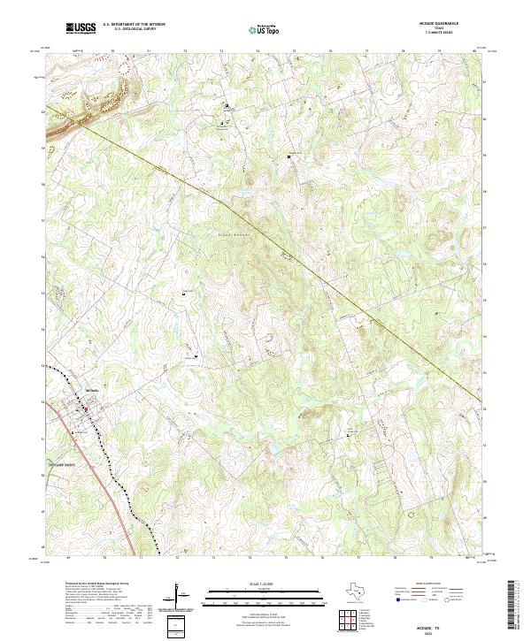
2022 Map of McDade
USGS Topo · Published 2022About this map
The town of McDade anchors the southwestern corner of this survey, where the street grid of Bastrop St and Maco St meets the open ranchlands of the Central Texas interior. This landscape is characterized by its numerous small burial grounds and springs, marking the ancestral footprints of rural communities along the Lee and Bastrop County line. The terrain rises toward the Yegua Knobbs, a series of prominent elevations that overlook the drainage of W Yegua Cr and Rocky Cr. Genealogists will find a wealth of specific local history here, tracing family connections through the New Knobbs Springs Cem, Old Knobbs Springs Cem, and the Siloah Cem. The map illustrates a contemporary rural economy where livestock operations like Martin Ranch and Stockade Ranch are served by a network of private and county roads including Knobbs Rd.
Find a feature on this map
59 named features on this map. Tap any name to fly to it.
Don’t see what you’re looking for? This feature index may not catch every label — zoom into the map to look around manually.
Map Details
Editions of this 2022 McDade Map
This is the sole edition of this map. No revisions or reprints were ever made.
Other maps of this area

1885 · Bastrop
USGS Topo · 1:125,000

1893 · Bastrop
USGS Topo · 1:125,000

1904 · Bastrop
USGS Topo · 1:125,000

1948 · Smithville
USGS Topo · 1:62,500

1948 · Elgin
USGS Topo · 1:62,500

1948 · Bastrop
USGS Topo · 1:62,500

1948 · Lexington
USGS Topo · 1:62,500

1950 · Lexington
USGS Topo · 1:62,500

1950 · Bastrop
USGS Topo · 1:62,500

1950 · Smithville
USGS Topo · 1:62,500