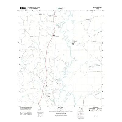
2012 Map of McDavid
USGS Topo · Published 2012About this map
The Escambia River carves a winding path through this corner of Florida, creating a complex wetland environment of oxbows and inlets such as Horseshoe Lake and Brown Lake. Historically centered around river and rail, the landscape is dotted with small settlements like McDavid, Bogia, and Barth. The map documents a rural corridor where legacy transport is evident in the proximity of Railroad St to the river's edge. Local genealogy is well-preserved through several family and community landmarks, including Coon Hill Cem and Juniper Cem. Significant water features like Chumuckla Springs and Mineral Springs highlight the hydrologic character of the basin. The presence of the Collier/Pine Barren Airpark and the crossings at Wiggins Bridge illustrate the modern connectivity of this wooded river valley.
Find a feature on this map
57 named features on this map. Tap any name to fly to it.
Don’t see what you’re looking for? This feature index may not catch every label — zoom into the map to look around manually.
Map Details
Editions of this 2012 McDavid Map
This is the sole edition of this map. No revisions or reprints were ever made.
Other maps of this area

1920 · Milton
USGS Topo · 1:62,500

1921 · Muscogee
USGS Topo · 1:62,500

1941 · Muscogee
USGS Topo · 1:62,500

1941 · Milton
USGS Topo · 1:62,500

1941 · Century
USGS Topo · 1:62,500

1943 · Muscogee
USGS Topo · 1:62,500

1943 · Century
USGS Topo · 1:62,500

1943 · Milton
USGS Topo · 1:62,500

1943 · Jay
USGS Topo · 1:62,500

1957 · Pensacola
USGS Topo · 1:250,000