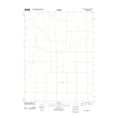
2012 Map of McDonald NE
USGS Topo · Published 2012About this map
Mayflower Cem serves as a lonely landmark in this high plains region of Rawlins County, situated near a sparse network of county roads and intermittent stream beds. The landscape is defined by the headwaters of several drainage systems, including the southern reaches of N Fork Driftwood Cr and the divided branches of Burntwood Cr. This survey illustrates the characteristic section-line grid of the western Kansas prairie, where development is primarily focused on agricultural land management rather than concentrated settlements. The terrain is etched by the E Fork Burntwood Cr and W Fork Burntwood Cr, showing how water—even in its seasonal forms—dictates the geography of the high plains.
Find a feature on this map
5 named features on this map. Tap any name to fly to it.
Don’t see what you’re looking for? This feature index may not catch every label — zoom into the map to look around manually.
Map Details
Editions of this 2012 McDonald NE Map
This is the sole edition of this map. No revisions or reprints were ever made.
Other maps of this area

1950 · Mc Donald
USGS Topo · 1:62,500

1951 · Mc Donald
USGS Topo · 1:62,500

1951 · Atwood
USGS Topo · 1:62,500

1954 · McCook
USGS Topo · 1:250,000

1954 · Goodland
USGS Topo · 1:250,000

1956 · Goodland
USGS Topo · 1:250,000

1957 · McCook
USGS Topo · 1:250,000

1957 · Goodland
USGS Topo · 1:250,000

1958 · McCook
USGS Topo · 1:250,000

1962 · Trenton SW
USGS Topo · 1:24,000