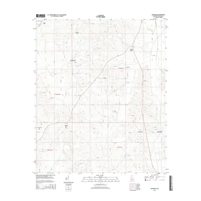
2015 Map of McDonald
USGS Topo · Published 2015About this map
McDonald and the surrounding rural communities of Neshoba County appear in this 2015 survey, characterized by a persistent pattern of small settlements and family cemeteries. The landscape is defined by the headwaters and tributaries of Beasha Cr and Beasha Creek, which transition into engineered drainage systems like the Lansilocher Canal and Fulton Canal in the eastern reaches. Local history is deeply anchored in these crossroads and rural clusters, where several generations are recorded at sites such as Mount Carmel Cem, Dixon Cem, and Morrow Memorial Cem. The map illustrates a network of county roads connecting established locales like Dixon, Linwood, and Good Hope, reflecting the continued importance of these named places within the Pearl River region long after many similar rural centers were consolidated or bypassed.
Find a feature on this map
81 named features on this map. Tap any name to fly to it.
Don’t see what you’re looking for? This feature index may not catch every label — zoom into the map to look around manually.
Map Details
Editions of this 2015 McDonald Map
This is the sole edition of this map. No revisions or reprints were ever made.
Other maps of this area

1953 · Meridian
USGS Topo · 1:250,000

1957 · Meridian
USGS Topo · 1:250,000

1962 · Edinburg
USGS Topo · 1:62,500

1965 · Meridian
USGS Topo · 1:250,000

1972 · Pearl River
USGS Topo · 1:24,000

1972 · Deemer
USGS Topo · 1:24,000

1972 · Union East
USGS Topo · 1:24,000
1972 · Philadelphia
USGS Topo · 1:24,000

1972 · Madden
USGS Topo · 1:24,000
1972 · Sebastopol
USGS Topo · 1:24,000