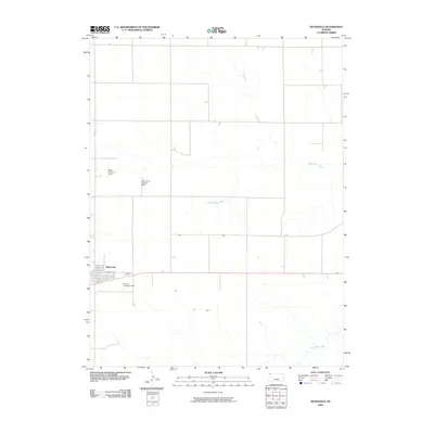
2009 Map of McDonald
USGS Topo · Published 2009About this map
McDonald anchors the western edge of this 2009 survey, sitting at the junction of Highway 36 and Lincoln St. This Rawlins County landscape is defined by the high plains agricultural tradition, where the grid of sections is occasionally broken by the winding courses of North Beaver Creek and Little Beaver Creek. One of the most distinctive patterns on this sheet is the presence of several small, privately named aviation facilities. These landmarks, such as the Black Landing Field, Jack Poore Landing Strip, and Briney Landing Field, illustrate a community where air travel is a practical extension of large-scale farming and ranching operations, providing an essential link across the Kansas prairie.
Find a feature on this map
8 named features on this map. Tap any name to fly to it.
Don’t see what you’re looking for? This feature index may not catch every label — zoom into the map to look around manually.
Map Details
Editions of this 2009 McDonald Map
This is the sole edition of this map. No revisions or reprints were ever made.
Other maps of this area

1950 · Mc Donald
USGS Topo · 1:62,500

1951 · Mc Donald
USGS Topo · 1:62,500

1951 · Atwood
USGS Topo · 1:62,500

1951 · Chardon
USGS Topo · 1:62,500

1951 · Dewey Ranch
USGS Topo · 1:62,500

1954 · Goodland
USGS Topo · 1:250,000

1956 · Goodland
USGS Topo · 1:250,000

1957 · Goodland
USGS Topo · 1:250,000
1978 · Beardsley
USGS Topo · 1:24,000
1978 · Mc Donald NW
USGS Topo · 1:24,000