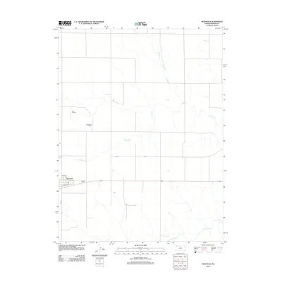
2012 Map of McDonald
USGS Topo · Published 2012About this map
McDonald anchors this high plains landscape in Rawlins County, where the street grid is clearly defined by routes like Lincoln St and N Railway St. The village's proximity to the rail line is reflected in its layout, sitting just north of the trackage while Co Rd 391 provides a primary north-south artery through the township. The surrounding terrain is characterized by the meandering drainages of N Beaver Cr and Little Beaver Cr, which cut through the agricultural sections.
Find a feature on this map
9 named features on this map. Tap any name to fly to it.
Don’t see what you’re looking for? This feature index may not catch every label — zoom into the map to look around manually.
Map Details
Editions of this 2012 McDonald Map
This is the sole edition of this map. No revisions or reprints were ever made.
Other maps of this area

1950 · Mc Donald
USGS Topo · 1:62,500

1951 · Mc Donald
USGS Topo · 1:62,500

1951 · Atwood
USGS Topo · 1:62,500

1951 · Chardon
USGS Topo · 1:62,500

1951 · Dewey Ranch
USGS Topo · 1:62,500

1954 · Goodland
USGS Topo · 1:250,000

1956 · Goodland
USGS Topo · 1:250,000

1957 · Goodland
USGS Topo · 1:250,000
1978 · Beardsley
USGS Topo · 1:24,000
1978 · Mc Donald NW
USGS Topo · 1:24,000