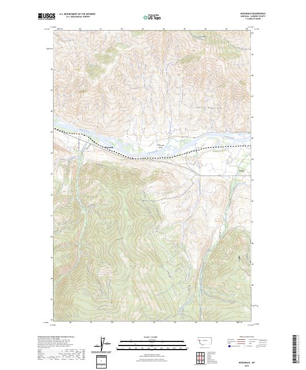
2024 Map of McDonald
USGS Topo · Published 2024About this map
The Flathead River cuts a wide path through this portion of Sanders County, defining the geography of the McDonald Basin and the southern edge of the Cabinet Mountains. The settlement of Dixon sits near the eastern edge of the sheet where the Revais Canal meets the valley floor, while the namesake McDonald is located further west along the riverbank. The landscape transitions from the high peaks of Sonyok Mtn in the north to a complex network of forest and access roads in the south, including Dixon 6000 and Dixon 7200. This area is characterized by the convergence of several significant drainages, such as Magpie Creek, Gunderson Creek, and Revais Creek, which flow from the surrounding highlands toward the central river valley.
Find a feature on this map
32 named features on this map. Tap any name to fly to it.
Don’t see what you’re looking for? This feature index may not catch every label — zoom into the map to look around manually.
Map Details
Editions of this 2024 McDonald Map
This is the sole edition of this map. No revisions or reprints were ever made.
Other maps of this area

1956 · Wallace
USGS Topo · 1:250,000

1959 · Tarkio
USGS Topo · 1:62,500

1959 · Alberton
USGS Topo · 1:62,500

1959 · Perma
USGS Topo · 1:62,500

1960 · Wallace
USGS Topo · 1:250,000

1964 · Dixon
USGS Topo · 1:24,000

1964 · Mc Donald
USGS Topo · 1:24,000

1964 · Melton Ranch
USGS Topo · 1:24,000

1965 · Sloan
USGS Topo · 1:24,000

1984 · Stark North
USGS Topo · 1:24,000