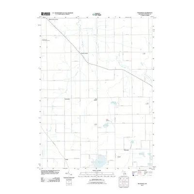
2011 Map of McDonald
USGS Topo · Published 2011About this map
The South Branch Black River winds through this rural landscape in Van Buren County, anchoring a network of small crossroads communities and agricultural tracts. Settlements such as West Bangor, Jericho Corners, and McDonald punctuate the grid of country roads, while several historic burial grounds including Monk Cemetery and Taylor Cemetery offer points of interest for genealogical research. The southern portion of the area is dominated by significant water bodies, most notably Van Auken Lake and Duck Lake, which contrast with the more structured drainage of Mud Lake Drain. Regional landmarks like the South Haven Area Regional Airport and the Circle Y Ranch Bible Camp illustrate the varied land use, from aviation to recreation, while smaller named points such as Friendsville and Maple Grove Corners preserve the names of local gathering spots within the township structure.
Find a feature on this map
60 named features on this map. Tap any name to fly to it.
Don’t see what you’re looking for? This feature index may not catch every label — zoom into the map to look around manually.
Map Details
Editions of this 2011 McDonald Map
This is the sole edition of this map. No revisions or reprints were ever made.
Other maps of this area

1927 · Hartford
USGS Topo · 1:62,500

1927 · Bangor
USGS Topo · 1:62,500

1927 · Benton Harbor
USGS Topo · 1:62,500

1927 · South Haven
USGS Topo · 1:62,500

1930 · South Haven
USGS Topo · 1:62,500

1930 · Benton Harbor
USGS Topo · 1:62,500

1931 · Bangor
USGS Topo · 1:62,500

1931 · Hartford
USGS Topo · 1:62,500

1943 · South Haven
USGS Topo · 1:62,500

1943 · Bangor
USGS Topo · 1:62,500