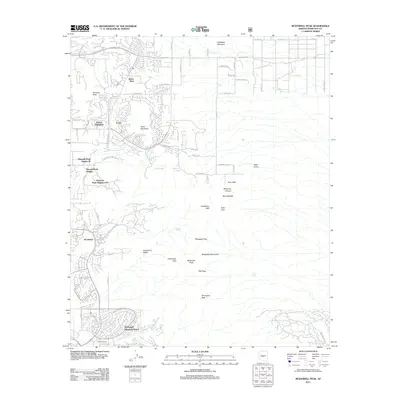
2011 Map of McDowell Peak
USGS Topo · Published 2011About this map
McDowell Peak and the high desert ridges of the McDowell Mountains dominate this 2011 survey, illustrating the intersection of suburban Scottsdale development and the preserved Sonoran landscape. To the south and west, master-planned communities like DC Ranch, McDowell Mountain Ranch, and Desert Highlands showcase the northward expansion of the valley's residential footprint. The Arabian Library serves as a modern landmark in this developing corridor, while the high peaks remain largely untouched by the surrounding grid.
Find a feature on this map
47 named features on this map. Tap any name to fly to it.
Don’t see what you’re looking for? This feature index may not catch every label — zoom into the map to look around manually.
Map Details
Editions of this 2011 McDowell Peak Map
This is the sole edition of this map. No revisions or reprints were ever made.
Other maps of this area

1904 · Camelback
USGS Topo · 1:62,500

1904 · Ft. McDowell
USGS Topo · 1:62,500

1906 · Camelsback
USGS Topo · 1:62,500

1906 · Ft. McDowell
USGS Topo · 1:62,500

1930 · Cave Creek
USGS Topo · 1:125,000

1939 · Cave Creek
USGS Topo · 1:125,000

1954 · Mesa
USGS Topo · 1:250,000

1957 · Mesa
USGS Topo · 1:250,000

1958 · Mesa
USGS Topo · 1:250,000

1960 · Mesa
USGS Topo · 1:250,000