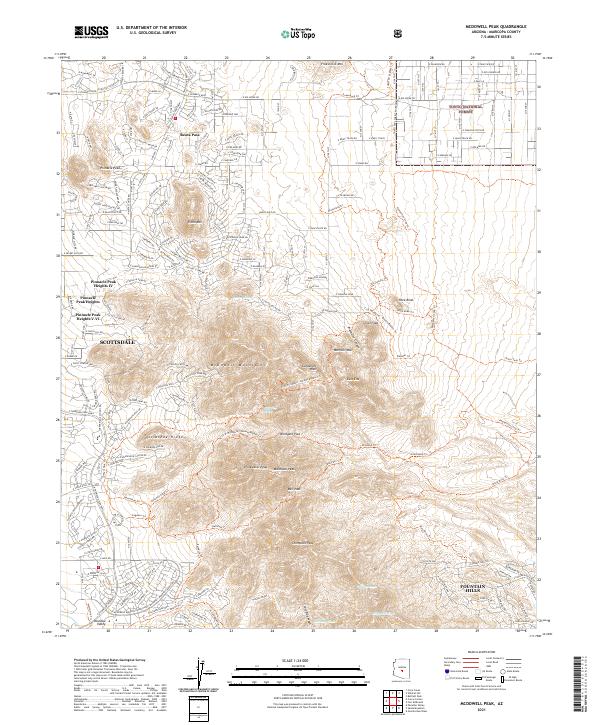
2021 Map of McDowell Peak
USGS Topo · Published 2021About this map
McDowell Mountains dominate the center of this map, showcasing the significant relief of the Arizona landscape between Scottsdale and Fountain Hills. The terrain is marked by prominent summits including Thompson Peak, McDowell Peak, and Drinkwater Peak, while ancient corridors like Windgate Pass and Bell Pass cut through the high ridges. In the northern reaches, the edge of the Tonto National Forest provides a buffer against the expanding residential developments of Reata Pass and Pinnacle Peak Heights. The mapping of numerous dry watercourses, such as Ochoa Wash and Taliesin Wash, highlights the complex drainage patterns essential to understanding the regional desert environment. A dense network of trails, including the Dixie Mine Trl and Pemberton Loop Trl, illustrates the modern transition of these mountains into a recreational and conservation focal point.
Find a feature on this map
48 named features on this map. Tap any name to fly to it.
Don’t see what you’re looking for? This feature index may not catch every label — zoom into the map to look around manually.
Map Details
Editions of this 2021 McDowell Peak Map
This is the sole edition of this map. No revisions or reprints were ever made.
Other maps of this area

1904 · Camelback
USGS Topo · 1:62,500

1904 · Ft. McDowell
USGS Topo · 1:62,500

1906 · Camelsback
USGS Topo · 1:62,500

1906 · Ft. McDowell
USGS Topo · 1:62,500

1930 · Cave Creek
USGS Topo · 1:125,000

1939 · Cave Creek
USGS Topo · 1:125,000

1954 · Mesa
USGS Topo · 1:250,000

1957 · Mesa
USGS Topo · 1:250,000

1958 · Mesa
USGS Topo · 1:250,000

1960 · Mesa
USGS Topo · 1:250,000