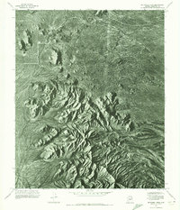
1971 Map of McDowell Peak
USGS Topo · Published 1972About this map
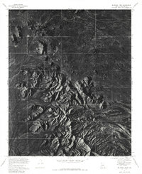
Mc Dowell Peak stands as the central landmark of this 1971 orthophotomosaic, providing a detailed photographic record of the desert terrain in Maricopa County. Unlike standard topographic sheets, this aerial perspective captures the complex shadows and geological formations of the Pinnacle Peak area and surrounding highlands with photographic clarity. This view reveals the undisturbed landscape of the early 1970s, showing the natural drainage patterns and scrub vegetation before significant suburban expansion reached this portion of the Arizona desert. The map is particularly useful for visualizing the specific rocky outcrops and landforms that have historically defined this region's physical character.
Find a feature on this map
2 named features on this map. Tap any name to fly to it.
Don’t see what you’re looking for? This feature index may not catch every label — zoom into the map to look around manually.
Map Details
Editions of this 1971 McDowell Peak Map
2 editions found
Other maps of this area

1904 · Camelback
USGS Topo · 1:62,500

1904 · Ft. McDowell
USGS Topo · 1:62,500

1906 · Camelsback
USGS Topo · 1:62,500

1906 · Ft. McDowell
USGS Topo · 1:62,500

1930 · Cave Creek
USGS Topo · 1:125,000

1939 · Cave Creek
USGS Topo · 1:125,000

1954 · Mesa
USGS Topo · 1:250,000

1957 · Mesa
USGS Topo · 1:250,000

1958 · Mesa
USGS Topo · 1:250,000

1960 · Mesa
USGS Topo · 1:250,000
Featured Places
- Scottsdale, AZ
- Fountain Hills, AZ
- Maricopa County, AZ
- United States
- Pinnacle Peak Heights V-VI, Scottsdale